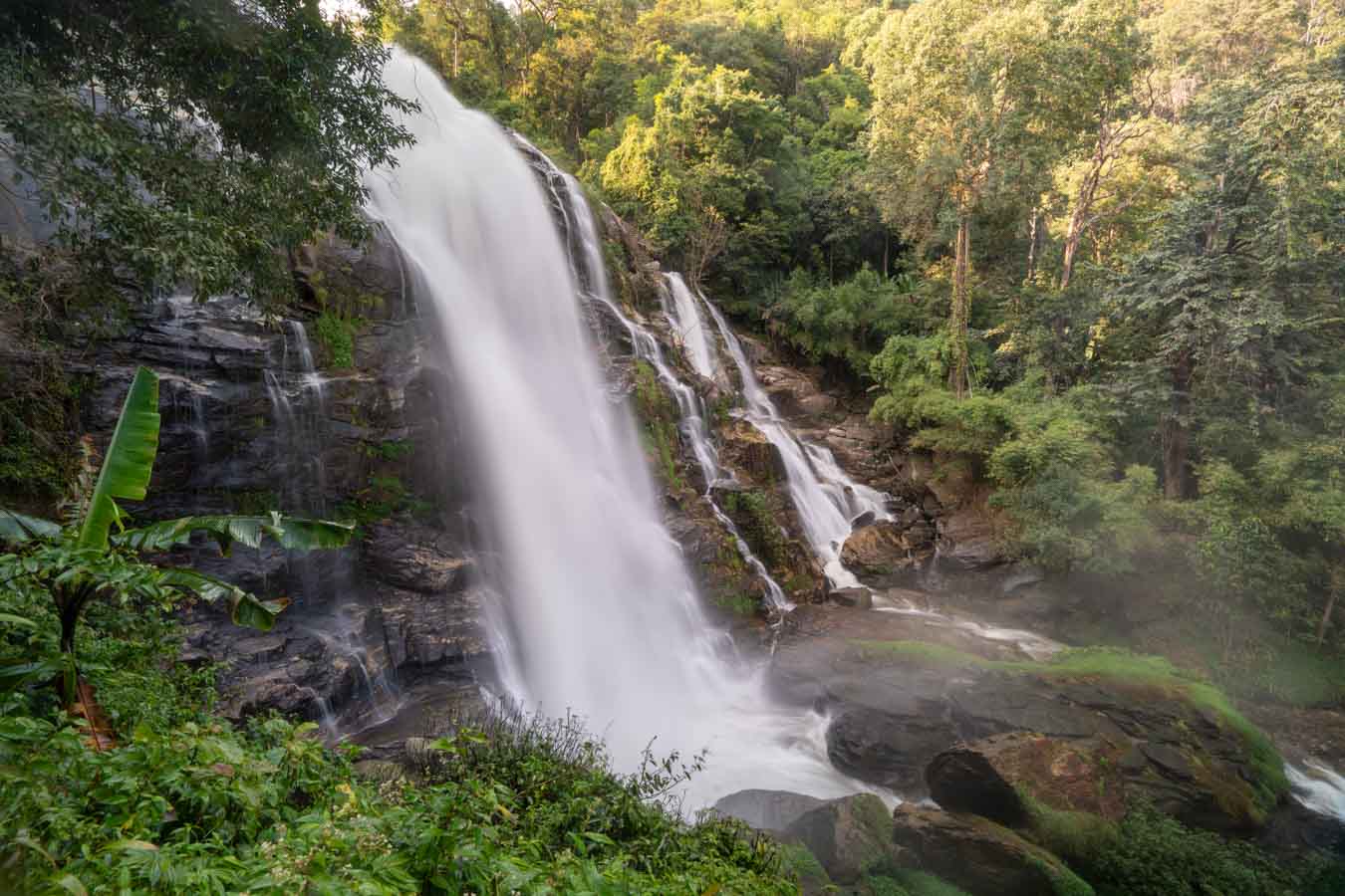
Wachirathan Waterfall
A powerful waterfall accessible via a short walking path from the main road.
View from the lower platform for full scale of the cascade.

Doi Inthanon National Park spans 482 square kilometers across elevation zones from 800 to 2,565 meters, creating navigation challenges for first-time visitors. The park's road network connects seven major zones, each requiring different approach strategies and vehicle access levels.

Quick answer
A doi inthanon tourist map divides the park into three main access corridors: the summit road connecting both royal pagodas and the highest point viewpoint (18 kilometers from the park entrance), the Wachirathan-Sirithan waterfall loop in the lower forest zone, and the Mae Pan nature trail requiring ranger escort. The summit road is fully paved and suitable for all vehicles, while secondary trails to Karen hill tribe villages and remote waterfalls require four-wheel drive during wet months.
The summit road climbs 1,700 vertical meters through five distinct forest zones, each transition marked by changes in temperature and vegetation that affect trail accessibility. Most visitors concentrate their route around kilometer markers 31 through 48, where the twin royal pagodas, summit viewpoint, and Ang Ka Luang nature boardwalk cluster within a four-kilometer radius. The doi inthanon tourist map reveals three waterfall tiers arranged by elevation and access difficulty. Wachirathan Falls at kilometer 21 sits directly beside the main road with paved parking, while Mae Ya Falls requires a separate 10-kilometer detour down a steep gravel road suitable only for experienced drivers. Sirithan Falls occupies the middle ground—300 meters downhill from a marked parking area at kilometer 31. The summit zone operates on a one-way traffic pattern during peak hours between 10:00 and 14:00, forcing visitors to sequence their stops ascending to the peak rather than backtracking. The park's orientation can confuse drivers expecting intuitive routing. The entrance gate faces east toward Chom Thong, but the summit road immediately curves northwest, meaning sunrise viewpoints require planning against your instinctive sense of direction. Trail markers use both Thai script and English romanization, though kilometer posts reference distance from Chiang Mai's city center rather than the park entrance, adding 58 kilometers to actual distances traveled inside park boundaries. Mobile signal drops completely above the royal pagodas at kilometer 41, making downloaded offline maps essential for anyone attempting the Mae Pan loop or venturing to the Pha Dok Siew nature trail. The park's official printed map distributed at the entrance gate includes contour lines but omits estimated walking times between points, which range from 15 minutes for the paved summit viewpoint to four hours for the full Mae Pan circuit. Ranger stations operate at three locations along the main road, each staffed from 08:00 to 16:00 with Thai-speaking guides who can mark current trail conditions on physical maps.
“The summit road climbs 1,700 vertical meters through five distinct forest zones, each transition marked by changes in temperature and vegetation that affect trail accessibility.”
Doi Inthanon National Park is located in Ban Luang, Chom Thong District, Chiang Mai 50160, Thailand. The most efficient way to navigate the park's extensive road network is by private car or hired transport, using a tourist map to track key junctions and elevation markers.
Highway 1009 (Chom Thong-Doi Inthanon Road)
Highway 1009 via Chiang Mai city center
Public Songthaew from Chang Phueak Bus Terminal to Chom Thong, then transfer
Arrive during the best arrival window of 06:00–09:00 to avoid congestion at the main park entrance and ensure optimal driving conditions on the mountain roads.
Navigating Doi Inthanon National Park involves a series of marked stops along the main ascent. These key locations are distributed along the park road, moving from the lower elevations toward the mountain peak.
A powerful waterfall accessible via a short walking path from the main road.
View from the lower platform for full scale of the cascade.
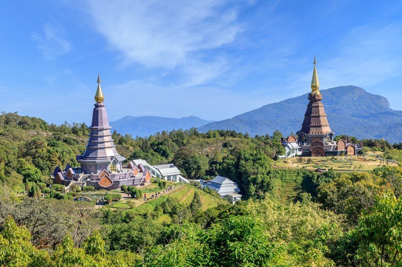
Two large, chedi-style monuments surrounded by manicured gardens at high elevation.
Visit the walking bridges between pagodas for mountain valley vistas.
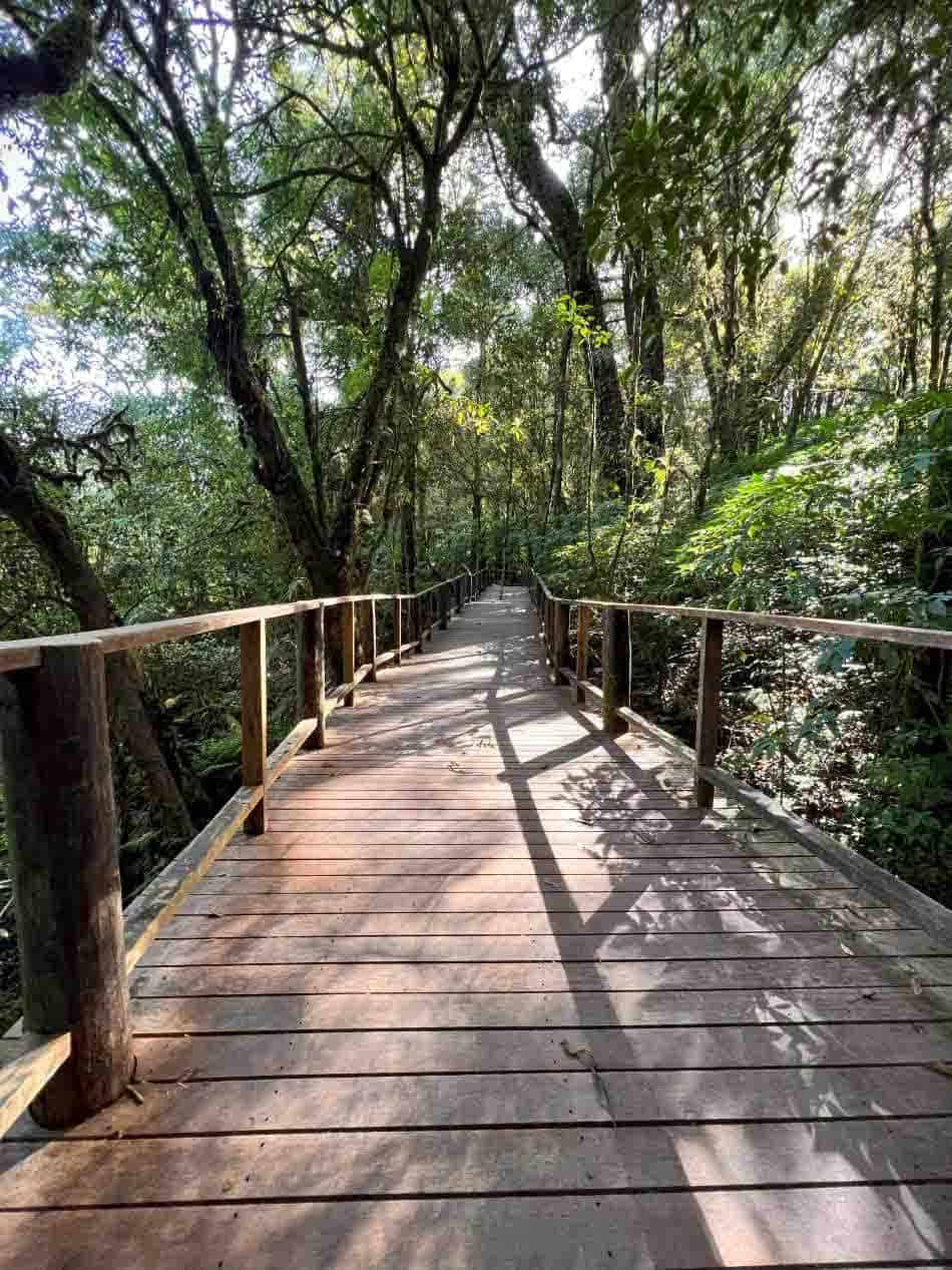
A short, elevated wooden boardwalk path through a high-altitude cloud forest.
Walk quietly to observe the unique moss-covered trees and ferns.
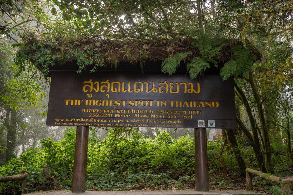
The highest point in Thailand, featuring a small shrine and interpretive signs.
Look for the summit sign marking the highest elevation point.
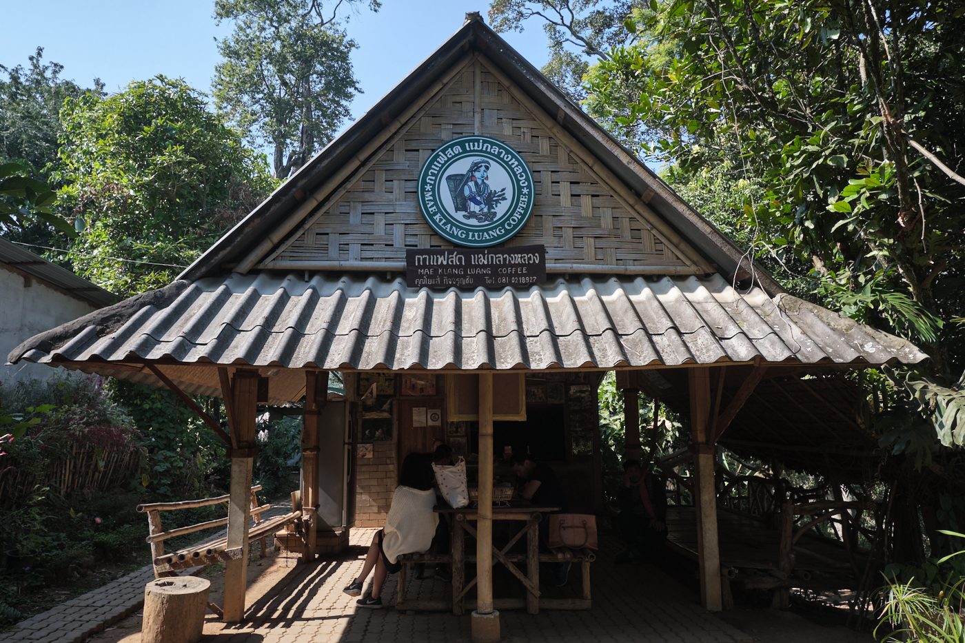
A local community area known for terraced rice fields and coffee cultivation.
Walk the perimeter paths during harvest season for clear views.
This route works for drivers with a full day, climbing steadily from the park entrance to the summit and back. Most visitors spend 6–8 hours covering the key stops along the main road.
Stop at the visitor center near the gate to collect a map, then drive 1 km to Wachirathan waterfall. The morning light is best for photos, and the spray is cooler before midday.
Continue uphill to the Royal Pagodas at km 41.5. Park in the lower lot and walk the paved loop between both structures. Vendors near the car park sell warm drinks if the temperature has dropped.
Drive the final stretch to the summit at 2,565 meters. Walk the short boardwalk trail through moss forest; it stays muddy year-round, so closed-toe shoes help. The summit marker is a quick photo stop.
Head back down the main road and turn off toward Mae Ya, the park's tallest cascade. The walk from the car park to the viewpoint takes 10 minutes on uneven steps.
Exit the park and stop in the village outside the gate. Several small restaurants serve northern Thai basics; most close by 15:00, so arrive before mid-afternoon.
The best arrival window is 06:00–09:00 to beat the crowds and enjoy clearer morning views before afternoon heat or mist. Navigating the Doi Inthanon tourist map during these early hours ensures access to popular trailheads before peak congestion.
Cool and dry, 5°C–20°C
This period offers the clearest skies for photography and observation. It is the peak season for trekking across the park map.
Hot and dry, 20°C–35°C
Temperatures rise significantly, making early morning exploration essential. Higher elevations remain cooler than the lowlands.
Humid with rain, 15°C–25°C
Expect frequent rainfall and mist, which can obscure views on the map. Trails may be muddy, but the landscape is lush.
—
Mid-week visits provide the most space at viewpoints and attractions. This strategy minimizes wait times at primary access points.
Verdict: The best time to visit is during the cool season from November to February, specifically arriving on a weekday between 06:00 and 09:00.
Doi Inthanon National Park operates daily throughout the week, including weekends and public holidays. Visitors should plan their arrival within the recommended window to ensure adequate time for exploration.
Everything you need to know about doi inthanon tourist map
While digital versions are increasingly common, having a reliable doi inthanon tourist map helps you orient yourself among the vast mountain trails and forest ecosystems. You can reference your itinerary to ensure you do not miss key viewpoints or waterfalls.
When reviewing your Chiang Mai park guide, prioritize identifying the locations of the twin pagodas and the summit trailhead. These areas contain significant elevation gains and specific paths that are easier to manage when you know the topography beforehand.
The most accurate resource is the official site, which provides essential context for the park layout. While you can view the official site to plan, supplemental tools often help visualize the distance between the main entrance and the higher altitude attractions.
Using a digital doi inthanon tourist map allows you to track your real-time position relative to major landmarks like the Kew Mae Pan nature trail. This is particularly useful for visitors who want to manage their energy levels during longer hikes.
The park features a well-marked road system that makes the primary park layout straightforward for most travelers. Most visitors find that following the main route with a clear visual guide keeps the journey organized and efficient.
You can certainly use your phone, though a cached doi inthanon tourist map is recommended since cellular service can be inconsistent at higher elevations. Downloading resources ahead of time ensures you have access to information even in remote sections of the mountain.
The national park is well-equipped with signage that directs visitors toward the botanical gardens and high-altitude cloud forest viewing points. These physical signs complement your planning materials to help navigate between parking areas and trailheads.
A quality map typically highlights the locations of restrooms, visitor centers, and the various cascade points along the mountain road. Familiarizing yourself with these markers ensures a smoother experience as you move through the diverse climate zones.
Doi Inthanon Elephant Tours
Read more GuideDoi Inthanon Entrance Fees and Hours
Read more GuideIs Doi Inthanon Worth Visiting?
Read more Tickets & toursDoi Inthanon Tours From Chiang Mai
Read more Tickets & toursDoi Inthanon Trekking Tours
Read more Tickets & toursDoi Inthanon National Park Tours
Read more GuideDoi Inthanon Dress Code and Logistics
Read more Tickets & toursPrivate Doi Inthanon Tours
Read more